
Oyster Box Stencil c. 1870
The area of our house referred to as the “Back Forty” is a large cement-floored room between the garage and the laundry room – a space created by my father in the late 1960s and designated as his “Work Room.” At that point in his life, he was semi-retired but had recently gone into the manufacture of plastics a la the advice given to Benjamin Braddock in “The Graduate.”
By the time Nyel and I moved into the house, the room had become a repository for “stuff.” Twelve four-drawer file cabinets lined one wall, stuffed with family correspondence and documents that had been partially catalogued in the 1980s and which now comprise the Espy Archives at the Washington State Historical Society. Plus bits and pieces of furniture to be mended, old too-good-to-throw-away pots and pans, vases and bedding – you know… “stuff.”
In our turn, Nyel and I have outfitted the walls with industrial shelving and all that stuff that we can’t bear to recycle or discard fills them up. Periodically, we sort through the boxes, reorganize, cull, label and mostly try to decide what to do with all that “stuff.” And, each time we do so, we rediscover items we had forgotten about or perhaps even looked for but couldn’t find – or things whose ‘disappearance’ had been blamed on our resident ghost, Mrs. Crouch.
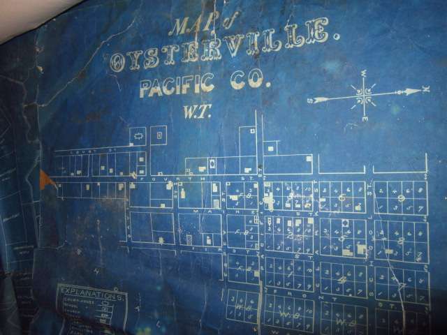
Blueprint of Early Oysterville Plat
So it was that a few days ago, Nyel found two treasures: a metal stencil once used to label crates of oysters being sent by the Morgan Oyster Company — a company in which my great grandfather was a partner back in the 1870s; and a blueprint of the Oysterville’s first plat created when Washington was still a Territory. We hadn’t seen either of them for years and scarcely remembered tucking them away for “safekeeping” in an old map case in the Back Forty.
The stencil, rusted and green with the patina of a hundred years, had been found in a refuse pile in Ocean Park by Nancy Lloyd and given to me some thirty-five years ago. It hung on the wall in my old Bay House, waiting to be suitably mounted and framed and was set aside when we moved here with that very goal still in mind. Maybe this time around it will happen.
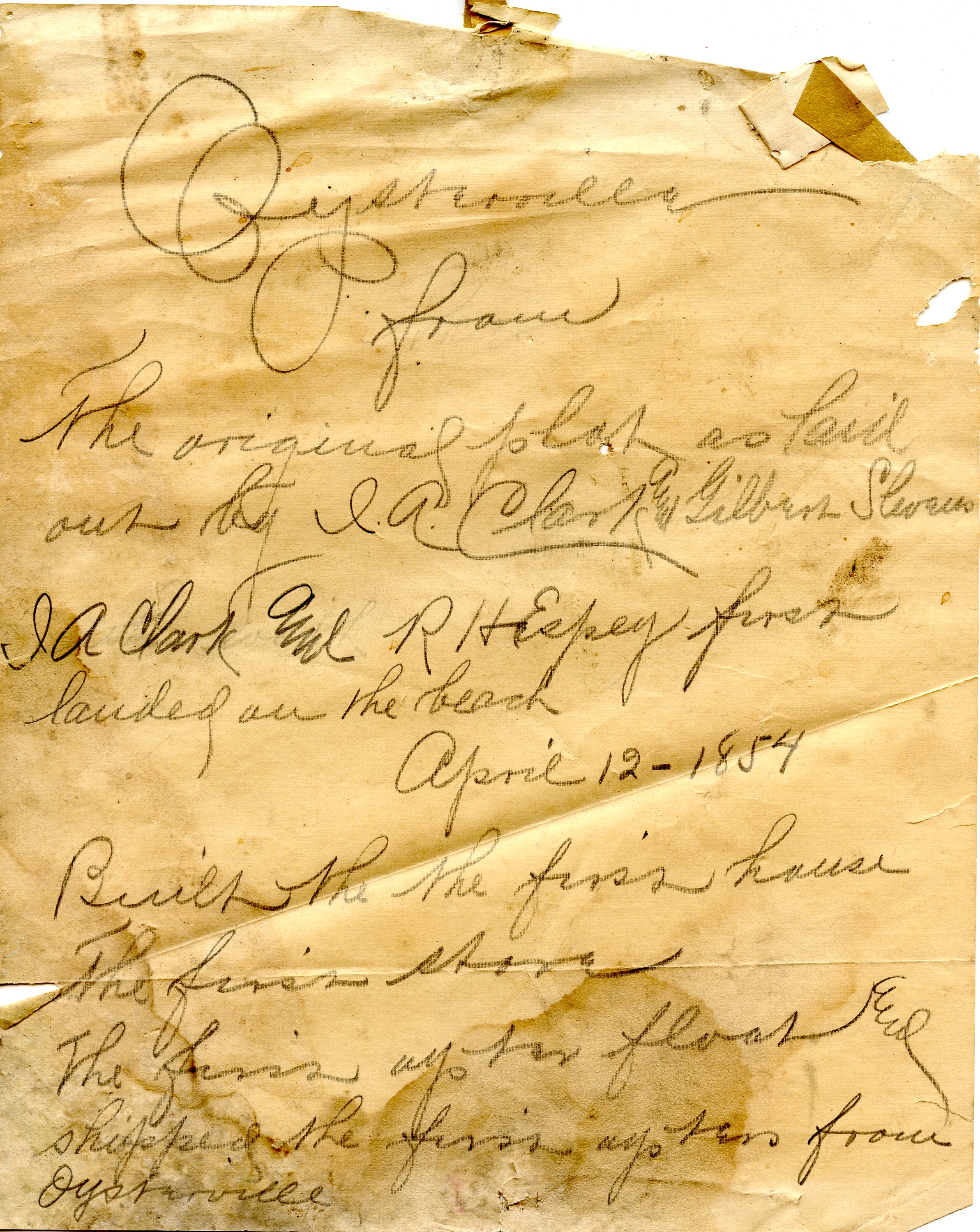
Note Attached to W.T. Blueprint
The blueprint was one of many ‘bits and pieces’ that Martha Murfin once gave me – probably, she thought, from the note attached to it, something her father Frank Turner (publisher/editor of The Ilwaco Tribune from 1925 to 1942) had used as reference material. I was delighted to learn from it that the original name of the lane between our house and Holways’ (now called Clay Street) was Davis Street, and that some of the other streets were named differently, as well.
I’m not sure what we’ll eventually do with that blueprint. It’s very fragile and needs help from a good conservationist. But maybe there are many better copies still in existence and the point is moot. Hard to tell. I think we’ll begin by consulting Barbara Minard, Collections Manager at the Columbia Pacific Heritage Museum.
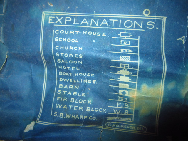
Early Oysterville Blueprint Key
Meanwhile, we’ll be pouring over it to learn what we can of the early village. For starters, it looks like the north end of town was meant to be fairly densely populated whereas the south end was planned to be just about as we see it today… And what were the “Fir Block” and the “Water Block” mentioned in the Explanation box, anyway?
Whoo Hoo! Let’s hear it for the Back Forty – ours and yours and everyone’s.
How wonderful to have such treasures!